Thursday, November 5, 2015

Travels, Foggy and Dismal


Barefoot Landing just before the fog thickened
   As we prepared to depart, the fog increased in density. Radar was of no use due the fog and the close quarters of the trees. As a result, it was a slow go for a while. 


Golf gondolas over the ICW


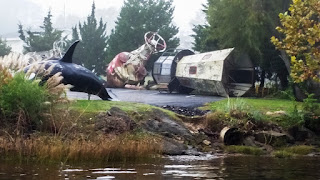
Marine Graveyard
   The normally pretty ride through Myrtle Beach was lackluster with the heavy skies and fog.  The magnificent homes, that line this part of the ICW, just appear less grand.  There are signs of the colors changing, but need the sun to really be noticed. I did take a photo of the golfing Gondola that crosses the ICW from the parking lot to the first tee per our son, Chris’ request.
 
White dots really are goats
   I was surprised to find a pair of goats roaming the water’s edge of the barrier island.  A little further south there were about a dozen more goats grazing. A search on the Internet found that the goats are returned to Goats Island in Murrells Inlet each spring for 7 months to graze to their heart’s content.  For the past 25 years, they have helped keep down the brush while stopping people from growing marijuana on the islands.
    While Pete was on his phone and computer, the helm was more challenging today, as I spent 45 minutes on my phone with Mom’s doctor while trying to take notes, steer, and adjust the throttle. Based on our conversation, she will need more testing.
     While exiting from under one of the high bridges, we passed Coast Guard, Sherriff Department and County Police Boats conducting a ground search.       

Grey with hints of fall
Ghostly image of an old tree
    The rest of the day was cool, damp, and dreary. We had traveled north on the Waccamaw River in spring.  The skies had been clear and the water blue. The trees and shrub green and in some cases flowery. The only negative of all that beauty was the biting files.  This time there were no biting files, not even mosquitoes, and few trees had leaves. Those that did were changing color, but blended into the grey without the sun. With the scenery being boring, I started to search the woods for the ancient trees, those with 3 foot wide trunks.  Towards the start of the river, I spotted one or two each mile. Further downstream, I couldn’t find any. I wonder if there was a fire, or perhaps the trees in this bijou were harvested and floated downstream.  I did find the sad remnants of one of these ancients at the lower end of the bijou. Only a few hints of civilization along the way, 2 marinas and Wachesaw Plantation.
Wacca Wache Marina
The forest thinned &
individual cypress
stand at waters' edge


Pete was able to talk with Mom’s doctor.  The testing revealed no changes, which is good news.  Hopefully, she will regain her strength and return to her retirement community in the near future.

Wachesaw Plantation & Golf Course


   The group decided to bypass Georgetown in favor of an earlier start, either via the Atlantic or down the ICW, by dropping anchors in Winyah Bay just east of the start of the Estherville Minim Creek Canal / ICW Channel. The dreary day continued until sunset. To the west, we could see a small ribbon of orange as the sun set. We were the only boats anchored.  By 8 PM, the clouds had cleared, the stars sparkled, and the 2.5 knot current was in full ebb.  Dan and Pete had a real challenge trying to get to the back of our boat to unload Bailey. After a number of tires, they finally met with success.  There are concerns when the current changes, but everyone is confident in their anchor.
 
A hitchhiker
   
A decision will be made in the morning as to which route we’ll take in the morning.


ICW Mile Marker    410
8.5 Hours       (Total 93.0 Hours)
57.7 Miles       (Total 582.7 Miles)

No comments:

Post a Comment